Waterworks
Waterworks Radio

Hachirōgata Lake

Activity 1957 - 1977
Location

Akita prefecture

Engineer
Adriaan VolkerPieter Jansen

Hachirōgata lake was historically the second-largest body of water in the country — with a circumference of around 80 kilometres. Situated on the Oga Peninsula in Akita prefecture, the lake and its surrounding areas had long faced challenges, including rice shortages due to cold-weather damage and frequent flooding. In the aftermath of World War II, the Japanese government initiated a large-scale reclamation project to transform the lake into usable farmland, aiming to boost food production and alleviate flooding. This ambitious plan called for the draining of the shallow lake — a task that required sophisticated engineering methods.

In 1954, the Japanese government invited Pieter Jansen and Adriaan Volker to assist with the project. Their plan, which was built upon earlier Japanese proposals, began in 1957 and was completed in 1977. The result was the conversion of 80% of the lake’s area into new agricultural land, while the remaining portion was designated as retention basins and curtain drains to manage water levels. The reclamation not only created valuable farmland but also led to the development of a new ecosystem. As surrounding plants began to invade the area, the region saw an increase in biodiversity, particularly among local bird species.

MUSIC BY CHIHEI HATAKEYAMA ( FIELD 33 )

This record is based on environmental sounds recorded around Hachirōgata lake, thereby expressing the current infrastructure of this reclaimed land in a sonic manner. Recordings were taken around the East and West drainage channels, the latitude and longitude intersection monument, Ogata bridge and the Ogata grassland wildlife conservation area and observation station.

Civil engineering has shaped urban form and planning in Japan for centuries.
For long, the country has been threatened by natural hazards such as flooding,
typhoons, earthquakes and tsunamis — with engineering traditionally
providing the necessary defences.

During the Meiji era, the Japanese government invited Dutch hydraulic engineers
('watermannen') to help improve water infrastructure. Their innovative solutions
exemplified international collaboration during Japan's critical modernisation
period and underscores the enduring bond between both nations.

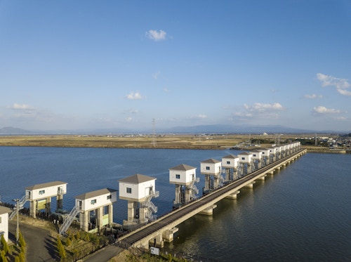
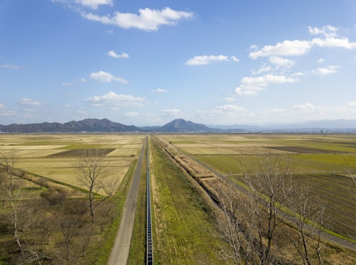
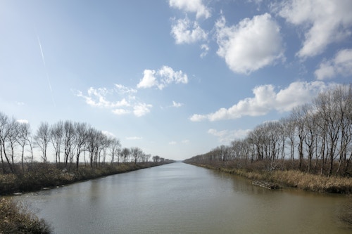
Initiated by Field Records, Waterworks covers over 50 Dutch waterworks developed
across Japan during the Meiji era. Navigate around the map and click on sites' names
to learn about their development — often accompanied by visual or sonic impressions.

長い間、台風、地震、津波などの自然災害に脅かされてきた日本。土木工学は従来より災害防御の
手段として、何世紀にもわたり日本の都市形態と都市計画を形成してきました。明治時代、日本政
府はオランダの水利技術者(「ウォーターマンネン」)を招き、国内の上水道インフラの改善に協力
してもらいました。オランダ人技師達が伝えた革新的な技術は、日本の近代化の重要な時期に大き
く貢献した国際協力の好例であり、両国の永続的な絆につながっています。

革新的な影響を与えたにもかかわらず、オランダ人技師による日本の治水管理への貢献は、今まで
大きく注目されていませんでした。本展示「Waterworks」は、明治時代に日本各地で開発された50
か所以上のオランダ上水道跡を展示した、フィールドレコーズ始動の日蘭共同プロジェクトです。
地図上の史跡名をクリックして、その場所の写真や音響とともに、歴史や開発当時の様子を学んで
みてみてください。